Affordable, hyper-precise GPS
SNIP is a new NTRIP Caster offering that combines simplified software with an active data-push to bring you all the benefits of NTRIP technology for a more affordable price.
SNIP is a new NTRIP Caster offering that combines simplified software with an active data-push to bring you all the benefits of NTRIP technology for a more affordable price.
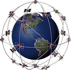
Obtain highly precise and accurate GPS location via TCP/IP...Normally, satellite navigation receivers must align signals sent from the satellite to an internally generated version of a pseudorandom binary sequence, also contained in the signal. Since the satellite signal takes time to reach the receiver, the two sequences do not initially coincide; the satellite's copy is delayed in relation to the local copy. By increasingly delaying the local copy, the two copies can eventually be aligned. The correct delay represents the time needed for the signal to reach the receiver, and from this the distance from the satellite can be calculated.
Build your own NTRIP network...In today’s plugged-in world where it seems that nearly everyone has a personal mobile device that provides 24/7 connectivity to the internet, it is surprising how many surveying companies still primarily use (often illegally unlicensed) UHF radios to transmit differential GNSS corrections. Commercially available 35W positioning UHF radios are most often chosen to transmit corrections because the coverage area they establish can be extensive, they are able to work in most remote and urban environments, and they are fully supported within data collection software. All of these properties are very desirable for single reference station RTK setups and provide an out-of-the-box solution for transmitting corrections. - See more at: http://www.xyht.com/professional-surveyor-archives/gnss-next-do-it-yourself-internet-rtk/#sthash.XhsGvIQi.dpuf
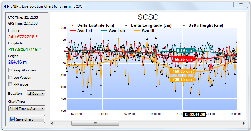
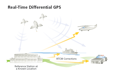
SNIP provides the ability to create real time plots of data stream...Real-time data (RTD) is information that is delivered immediately after collection. There is no delay in the timeliness of the information provided. Real-time data is often used for navigation or tracking. Some uses of the term "real-time data" confuse it with the term dynamic data.
Donec ullamcorper nulla non metus auctor fringilla. Vestibulum id ligula porta felis euismod semper. Praesent commodo cursus magna, vel scelerisque nisl consectetur. Fusce dapibus, tellus ac cursus commodo.
Donec ullamcorper nulla non metus auctor fringilla. Vestibulum id ligula porta felis euismod semper. Praesent commodo cursus magna, vel scelerisque nisl consectetur. Fusce dapibus, tellus ac cursus commodo.

Donec ullamcorper nulla non metus auctor fringilla. Vestibulum id ligula porta felis euismod semper. Praesent commodo cursus magna, vel scelerisque nisl consectetur. Fusce dapibus, tellus ac cursus commodo.